Imagen 1 de 2


Galería
Imagen 1 de 2


¿Quieres vender uno?
Mapa 1862 ~ HEMISFERIOS DEL MUNDO - RÍOS MÁS LARGOS por S. A. Mitchell (12x15)-#30-
USD48,00
Aproximadamente41,36 EUR
Estado:
“This 160-year-old map is in near pristine condition, a rare find. It is not *new* or in *new* ”... Más informaciónacerca del estado
Oops! Looks like we're having trouble connecting to our server.
Refresh your browser window to try again.
Envío:
Gratis USPS Ground Advantage®.
Ubicado en: Schertz, Texas, Estados Unidos
Entrega:
Entrega prevista entre el sáb. 30 ago. y el sáb. 6 sep. a 94104
Devoluciones:
30 días para devoluciones. El vendedor paga el envío de la devolución.
Pagos:
Compra con confianza
El vendedor asume toda la responsabilidad de este anuncio.
N.º de artículo de eBay:406044805216
Características del artículo
- Notas del vendedor
- Size
- the page is 12x15
- Color
- Beautiful original bright, hand tinted colors.
- Cartographer/Publisher
- S. Augustus Mitchell
- Date Range
- 1862
- Ref
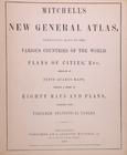
- The title page is only for reference purposes. It is not included
- Type
- Wall Map
- Format
- Atlas Map
- S&H
- Free S&H USA - Calculated S&H Worldwide
- Year
- 1862
- Original/Reproduction
- Antique Original
- Country/Region
- United States of America
- Age
- over 160 years old
Descripción del artículo del vendedor
Acerca de este vendedor
MapHatter
99,4% de votos positivos•28 mil artículos vendidos
Registrado como vendedor particularPor tanto, no se aplican los derechos de los consumidores derivados de las leyes de protección de los consumidores de la UE. La Garantía al cliente de eBay sigue aplicando a la mayoría de compras. Más informaciónMás información
Votos de vendedor (9.711)
- w***3 (333)- Votos emitidos por el comprador.Mes pasadoCompra verificadaWhat should have been a speedy delivery via Ground Advantage delayed due to the incompetence of the USPS. Item sent from Texas to Chicago, then to Pennsylvania (!), the back to Chicago, finally delivered on July 22. The seller did everything right: prompt shipping, excellent packaging, item as described and worth the price. The score: Seller 10, USPS 0.
- o***d (897)- Votos emitidos por el comprador.Mes pasadoCompra verificadaItem exactly as described and shipped in a very protective package. It took almost 3 weeks for the shipping but the shipping was included in the price. Very good value and worth waiting for. Thank you!
- 1***l (18)- Votos emitidos por el comprador.Últimos 6 mesesCompra verificadaFinally! The "ancestral plat map" arrived and is well worth the long wait!. It is as nice or even nicer than what the seller described. It was packaged adequately, I don't know why it took from 11 April to 5 May to be delivered, but I suspect this was outside the control/responsibility of the seller. I am grateful that this irreplaceable old document was not forever "lost in the mail." Thank you, thank you, thank you!1872 Plat Map ~ FENTON Twp., WHITESIDE Co., ILLINOIS - (15x18)-#10 (#405722860174)
Más que explorar:
- Ropa tradicional y del mundo talla S para mujer,
- Cañas Mitchell,
- Libros de mapas y atlas con mapa,
- Carretes de pesca Mitchell,
- Culottes y pantalones largos de ciclismo talla S,
- Manual de pesca Mitchell,
- Carretes de pesca vintage Mitchell,
- Recambios y accesorios de carretes de pesca Mitchell,
- Muelles de carretes de pesca Mitchell,
- Camisetas de fútbol de clubes españoles de manga larga talla S

